Geographic Information System (GIS) Skill Set
Students who complete the GIS Skill Set may develop skills applicable to a variety of industries, including conservation, agriculture, mining, civil construction, engineering, health, and defence.
Overview
Campus Albany
When All year round
Study Mode On Campus | Online
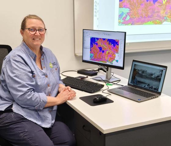
This skill set specifies the skills and knowledge required to coordinate spatial data manipulation and analysis to meet task specifications. It includes analysing task needs and geographic information system (GIS) data format requirements, assessing potential analysis tools and models, and identifying the limitations of analysis results. The unit also includes verifying data source integrity, manipulating and analysing data, and preparing results to inform decision-making.
- Do you have an inherent mix of technical and analytical skills that you would like to develop further?
- Would you like a career path that involves solving real world problems using spatial data, technology, innovation and mapping?
Then this is the course for you.
To make an informed choice about the suitability of this course, please consider the essential skills and knowledge below. You must:
- Have good attention to detail.
- Have good colour vision.
- Enjoy working with patterns and data and how they relate.
- Demonstrate well-developed problem-solving skills.
- Show well-developed digital literacy.
- Be able to work independently as well as within a team.
This course gives you the skills and knowledge to use Geographic Information System (GIS) data formats. It includes verification of data source integrity, manipulating and analysing data, preparing results to inform decision making and identifying the limitations of the results. It is designed to give you the skills applicable to a variety of industries including Conservation, Agriculture, Mining, Civil Construction, Engineering, Transportation, Urban Planning, Health, and Defence.
Time Commitment – You will need to allocate appropriate time to complete this course. This includes attending classes on-site and/or online as outlined in the study mode; and undertake independent study outside of class hours, including private study, assessment preparation, research and complete assessment requirements.
Below are some of the important personal skills you will be required to develop and demonstrate during training. These skills are highly valued by industry:
- Respectful Communication - Interact with people from different backgrounds, share ideas effectively and build trust.
- Teamwork – Collaborate with others, show them respect, and be open to feedback.
- Problem Solving - There is always a solution. How do you respond to a challenge? If you spot a problem, we encourage you to ask questions, clarify as needed, and respond appropriately within your training.
- Initiative - Stay motivated, take proactive steps, and seek help when necessary.
- Planning - Manage time well. Knowing how to prioritise and completing your tasks efficiently are crucial for your success.
- Self-Management - Reflect on your performance. Reflection is a powerful tool for growth and success as a student at South Regional TAFE. Being a professional in the workplace can mean learning when to accept responsibility for your failures as often as your successes. This is how we learn!
- Learning – Recognise what your strengths already are. Then embrace all the new knowledge and experience from your South Regional TAFE journey to grow as a student. Some of the skills you will learn include:
- Produce maps.
- Verification of data source integrity.
- Spatial data manipulation and analysis.
- Prepare results to inform decision making.
- Identify limitations of results.
- Technology - Adapt to new tools, access digital resources, and integrate technology into your learning.
Important information
Select your preferred campus and apply
All year round, 2026
Details
Course fees
| Tuition | Resource | Total fee* | |
|---|---|---|---|
| General | $732.00 | $53.80 | $785.80 |
| Concession | $220.50 | $53.80 | $274.30 |
Indicative Fees and Charges
The fees quoted are estimates only and are for all units in the course for students enrolling on a full-time basis. If you're a student that has successfully completed a lower-level qualification that is a prerequisite for this course, you'll only pay for the units that you need to enrol in to complete this course. Please view the full list of Fee Disclaimers
Units
Core
| National ID | Unit title |
|---|---|
| AHCLPW410 | Produce maps for land management purposes |
| CPPSSI3011 | Produce basic maps |
| CPPSSI5064 | Conduct complex spatial data analysis |